We have begun looking ahead to Satellite Station 4.0 and where we want to go next after our ARISS crew contact is complete. Our goals for the Satellite Station 4.0 include …
We are planning a series of upgrades to our Satellite Stations enhance Remote, Transportable, and Portable operation. These plans are firming up and installation of the upgrades is well underway. You can read more about what we are doing via the link above.
The weekend of August 25th and 26th brought a break from the rainy and hot weather and provided beautiful weather for two NARS summer activities.
On Saturday, August 25th, we held our Family Picnic at Greeley Park in Nashua. It was a potluck lunch and members brought lots of great food to eat. It was an enjoyable time, eating great food and chatting with our Ham Radio friends and their families.
Here is a gallery of pictures from the picnic:
Hamilton K1HMS and Liz
Ben and Abby
Abby AB1BY and Gretchen Finchum
Josi and Tony Rizzolo KC1DXL
Fred AB1OC and Anita AB1QB
Frank N1DGQ and John W1SMN
Mike K1WVO and Jean K1AVM and Dennis K1LGQ
Tom Mahon AB1NS and Family
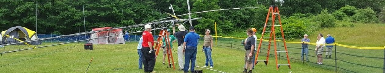
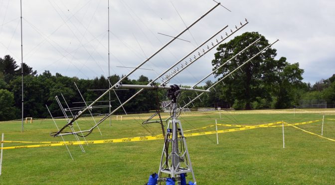
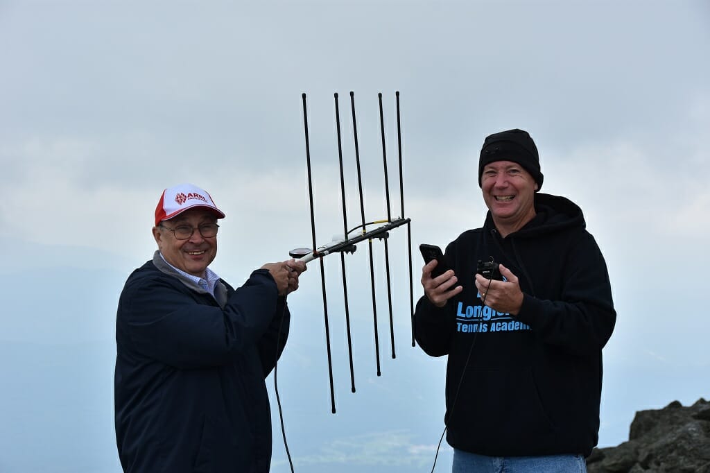
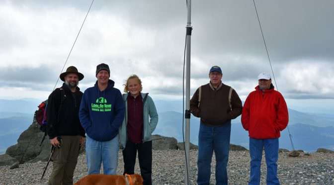
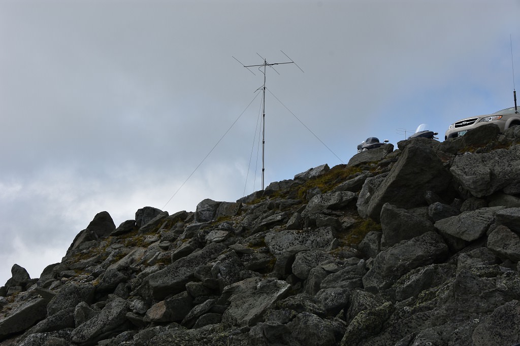
Bright and early on Sunday, August 26th we all headed to Mount Washington for our SOTA/POTA activation. We had another beautiful day with relatively warm temperatures for Mount Washington’s 6000 ft elevation in the 50s. Most of us drove up on the scenic Mount Washington Auto Road. We made contacts on many modes and bands on the mountain including
Satellite contacts using an Elk Yagi and a Kenwood HT
6 meter SSB and FT8 using the Icom 7300 and an M2 6 meter Yagi
Do you read QST magazine or see articles on FaceBook about DXpeditions and think to yourself, “man, I’d really like to do that.” Don’t have the time, the money or the XYL or OM won’t let you go on a DXpedition. Yeah, me too!
6M Antenna on the Mountain
Well, later this month the Nashua Area Radio Society will be doing its own mini-DXpedition to the top of Mount Washington! On Sunday, August 26th we’ll be activating Mount Washington for Summits on the Air and Parks on the Air.
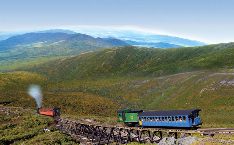
The top of Mount Washington sits at 6,288 feet above sea level. It is the highest peak east of the Mississippi and north of the Carolinas and is known for some of the “worst weather in the world”. We’re hoping that doesn’t hold true on the 25th. Don’t let the weather or the altitude deter you from taking part in this event! Last year we had a couple of members that climbed up the mountain, some that drove (yes, there is a paved road up… a very steep and narrow road) and we even had some members take the Cog Railway – which is an adventure in itself!
The Mount Washington Cog Railway:
The Mt. Washington Cog Railway
The unique way up the mountain is from the Mount Washington Cog Railway. Mt. Washington’s cog railway is the world’s first mountain climbing cog railway. Also, it is the second steepest rack railway in the world with an average grade of 25% and a maximum grade of over 37%!
The Mount Washington Cog Railway Access Road is located off Rte. 302 in Bretton Woods and trips begin at 8:00 am and run through 4:30 pm. Tickets can be purchased in advance on their website.
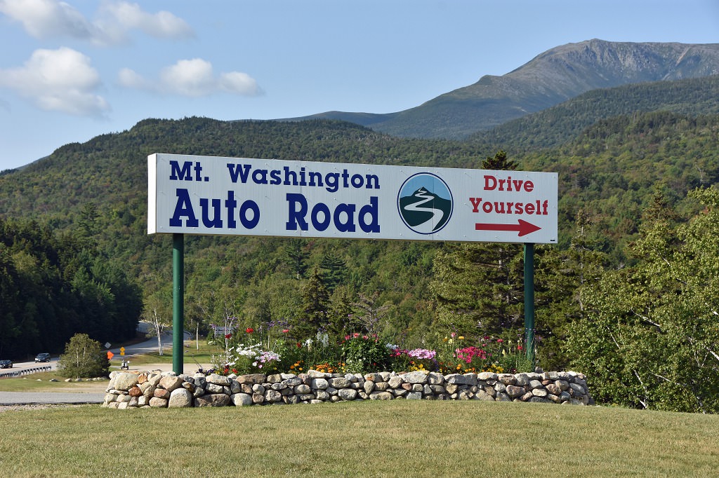
The Mount Washington Auto Road (Drive Yourself):
Mt. Washington Auto Road
The Mount Washington Auto Road is located in Gorham, New Hampshire on the other side of the mountain from the Cog Railway. The auto road is open from 7:30 am until 6:00 pm on August 25th and rates start at $29 for a car and driver and go up from there.
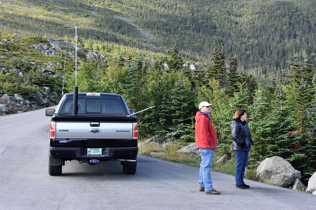
Tony, KC1DXL & Anita, AB1QB take in the views on the auto road
This drive is not for the faint of heart! There are panoramic views and you will travel through four distinct climate zones on your way up the Northeast’s highest peak. If you are not comfortable with heights or narrow winding roads without guard rails you may want to check out the guided tours or the hiker’s shuttle to the top.
Please note that there are some vehicle restrictions that you want to check out if you plan to drive yourself.
Take a Guided Tour:
Tours of Mt. Washington
Guided tours start at the base of the Mount Washington Auto Road beginning at 8:30 am and you have the option of a two hour guided tour or three hour guided tour. The disadvantage of the guided tours is that you are not on your own schedule and time at the top is limited.
The tours do sell out so you will want to book your tickets early if this is the option for you.
Hiker Shuttle:
Connor, KC1GGX descending Tukerman’s Ravine
Another way up/down the mountain is the Hiker Shuttle. The Hiker Shuttle leaves from the Stage Office at the base of the Mount Washington Auto Road beginning at 9:00 am. The shuttle then leaves on an as-needed basis, so waits of an hour or more may be necessary. The one way down option can be a little tricky as rides down are sold on a first come, first served basis.
Hike Up:
The final way up/down the mountain is hiking. Although this may not be for everyone – this is a very strenuous hike – it is the most rewarding.
There are two starting points for getting up Mount Washington – the east face and west face of the mountain. The east face trails begin at the Pinkham Notch Visitor Center which has information and basic rooms available for rent. Reservations in advance are a must!
The East Face:
East Face of Mt. Washington
The easiest trail (easiest is probably not the right term for any trail on Mount Washington) on the east face of the mountain is Tuckerman’s Ravine for both the ascent and descent. Lion’s Head is the same distance, but slightly steeper. It is not the best for a descent. Boott Spur is another option, which is not any more difficult than the other trails but is much longer. The benefit of hiking Boott Spur trail is the amazing views and not many crowds!
Abby, AB1BY near Lion’s Head on Mt. Washington
The West Face:
West Face of Mt. Washington
The trails on the west face of Mount Washington begin from Mount Washington Cog Railway and offers two trails, the Jewell Trail and Ammonoosuc Ravine Trail. The Ammonoosuc Ravine Trail ascends via Lake of the Cloud Hut where you can stop and get a hot coffee, hot chocolate, water or some snacks… not to mention the fantastic views!
Lake of the Clouds Hut
If you are planning on hiking an early start is an absolute must, especially if you plan to have any time to operate on the summit. Club members that are planning to hike please let me know. It would be fun to have a group to hike with as well as safer for everyone involved.
Accommodations:
The Mt. Washington Hotel
There are many accommodations in the area ranging from beautiful hotels to primitive camping areas. Again, booking in advance is a must! Many of the camping areas in the White Mountain National Forest are booked on a first come, first served basis. They do not take reservations in advance.
Primitive Camping near Mt. Washington
Join in on the Fun!
If you have any questions please let me know. I’d love to see a big group of you at the summit!
Radio Amateurs Developing Skills Worldwide
We use cookies to ensure that we give you the best experience on our website. If you continue to use this site we will assume that you are happy with it.