Back in 2010, I was a postdoc in the particle theory group at National Taiwan University in Taipei. I was working with a buddy, a German fellow, and in the middle of talking about made up particles (actually they’re real) in imaginary time (this is an actual “thing”), he showed me a neat YouTube video that he found. As we watched, we saw two young fathers design and launch a high altitude balloon (HAB) to stimulate interest in their very young sons. Of course, the best part of this entire endeavor was the video footage they recorded during the ascent/descent. It was awesome; in the original definition of the word. I immediately developed HAB envy and wanted to do this myself. I told my future XYL, Anne, about this and she said if I came back to the U.S., she would help me design one.
Fast-forward to 2011. I came back home, and though Anne offered to help, I was adjusting to a new job in VA and had zero time to dedicate to it and coupled to that, zero money. The dream would have to wait.
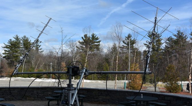
Fast-forward to early winter 2016 (I think it was early 2016). Fred, Anita, Jamey, Tony, myself, and others were sitting at the Dartmouth-Hitchcock facility during one of our Youth Days. We had just finished lunch and were brainstorming ideas to engage young people in amateur radio. Fred had mentioned, how about a high-altitude balloon carrying APRS? Bing. Bang. Boom. That was all I needed to hear. This was the opportunity literally right in front of me to check the box. So, as you can guess, I was in.
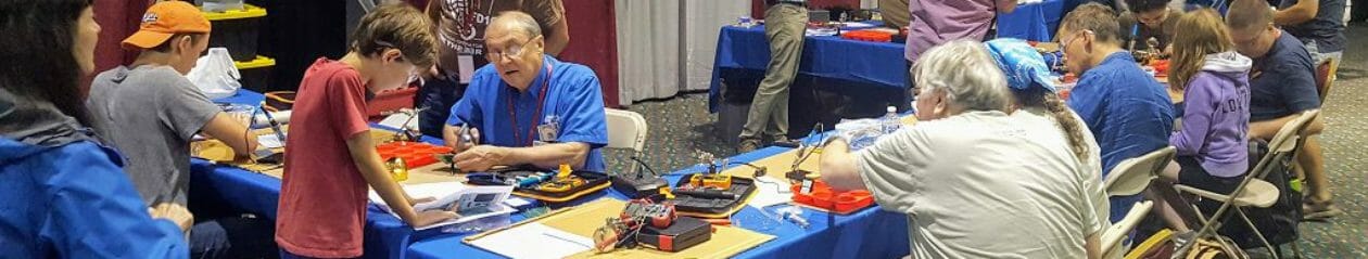
The team had a lot of work in front of us. Some of you have heard us proselytizing the good word at our meetings. This whole project would not work if it were just about a solitary, singular balloon launch. There had to be a hook; had to be something that would allow us to continually interact with the potential participating students. What we had decided was to create a STEM opportunity in the classroom. For those of you unfamiliar with STEM, it stands for Science, Technology, Engineering, and Mathematics. It represents a body of activities and teaching to foster and nurture this type of education in students. It takes the form of FIRST robotics, programming courses for kids, DIY electronics for kids. You name it, it’s probably a “thing” already. So this is what we tasked ourselves with.
To move forward, we had to establish a potential curriculum and target schools that we could work with and hopefully engender a long-lasting partnership with. The ideal case scenario we envisioned would be, to begin with, students as freshman and work with them until graduation; maybe even getting a senior thesis out of it.
I won’t bore you with all the details, but to name a few, we had bi-monthly WebEx conversations to discuss how to move forward, solicited schools, developed a presentation schedule, created a TON of PowerPoint slides to be presented in the classroom, ordered and tested the HAB and its components, organized an Open House at Fred/Anita’s QTH, and of course figured out a launch date — let’s talk about that next.
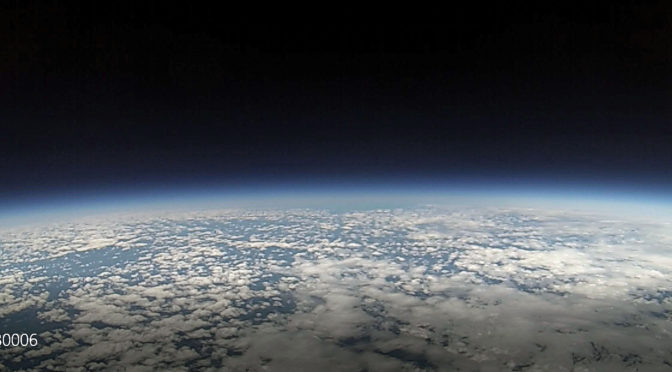
Ah, launch time. The culmination of 7+ years of waiting was actually going to happen. I could measure time by prepending the phrase “T-minus” to my system of units — Pretty cool. The morning of, many of us gathered at the requisite spot; the anticipation was pretty palatable. After the exact launch locale was ascertained, we prepped and began to inflate the balloon. Spoiler alert: We under-filled the balloon due to a misunderstanding of the instructions from the company which led to a longer flight time. The moment I let the balloon go, I swear my mind went through all the charts I made, all the prep work the team went through, and an overwhelming sense of pride at the accomplishment we achieved.
We quickly cleaned up and adjourned to a local restaurant where we viciously ate our food and just as viciously scoured the interwebz (aprs.fi) to get the latest update of the balloon’s telemetry. Since the update time was about one minute, it was obvious that Einstein’s theory of Special Relativity was at work; each minute felt like an eternity in my reference frame.
Finally, touchdown! In RI. Ok…sure. We predicted SE of Worcester, but it was RI. Fred called me a few times to update me on the HAB’s status after recovery. I asked him to let me know when the data would be available in the Dropbox. When I saw this, I instantly turned to MATLAB and created the following plots from the telemetry data on the flight computer. (Note: It’s update time is every 6 sec, so we get more accurate updates than APRS)
IMHO, I think the most interesting plots are those of the pressure vs altitude of the HAB and the temperature vs altitude. These are fascinating since:
- We have theoretical models from NASA with which to compare with.
- It’s unfathomable we can record this data THAT HIGH UP with such simple tools.
Below, I’ll only show the results from the ascent. (The descent essentially looks the same). Also, for posterity, I included the NASA predictions which for those of you who are more mathematically minded (all of you, right?!) can sink your teeth into.


What I find fascinating is that the pressure the HAB recorded (shown in blue) lies essentially on top of the NASA predictions (shown in black). Moreover, the temperature shows good agreement qualitatively: namely a sharp decrease until a particular altitude, then it levels off, and finally begins to increase again. Where those boundaries occur differs between NASA and our local measurements from Winchester, NH. But, the trends are the same. Very encouraging. The next most interesting plots are those derived from the telemetry data. The first is the ascent altitude vs time:
 The vertical speed seems to be essentially constant. This makes sense so long as the vertical lift force from the Helium balances out the downward force of gravity. And this is essentially what we are seeing here and is what is modeled by our HAB prediction website. On the way down, the curve looks a bit more interesting:

Initially, the HAB seems to be accelerating (since there is some curvature to the line until about 240 min of elapsed time), but after it encounters more air as it falls, it seems the parachute is deployed and therefore reaches terminal velocity (e.g. constant speed)
The upshot of all this stuff is I made a TON of plots on launch night (from the APRS data) and the following morning (from the flight computer data) which I have shown here. I won’t bore you with the other results, but there is a wealth of info one can calculate and learn about.
This entire experience has been an absolute pleasure to be a part of on many, many levels. I just hope we, the HAB team of NARC, have begun to inspire some kids in STEM and amateur radio due to our efforts.
Best and 73,
Brian, AB1ZO
Hashtag: #N1FDHAB


")