Category Archives: Space

Articles and other information related to Space Communications using Satellites, High-Altitude Balloons, Earth-Moon-Earth (EME), etc.

Field Day Satellites, VHF+ and Fox Hunting

We will have lots of great activities for folks who are interested in operating on the VHF and above bands at Field Day 2019. Here are some of the activities that we’ll be doing:

  • Satellite Contacts using a Portable Computer Controlled Satellite Stations
  • Weak Signal SSB, CW, and FT8 Contacts on 6m, 2m, and 70cm
  • Fox Hunting using Radio Direction Finding (RDF) to find hidden 2m Radio Transmitters
  • Satellite Station, VHF+ Station, and Fox Hunting Training

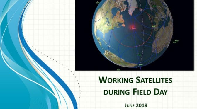
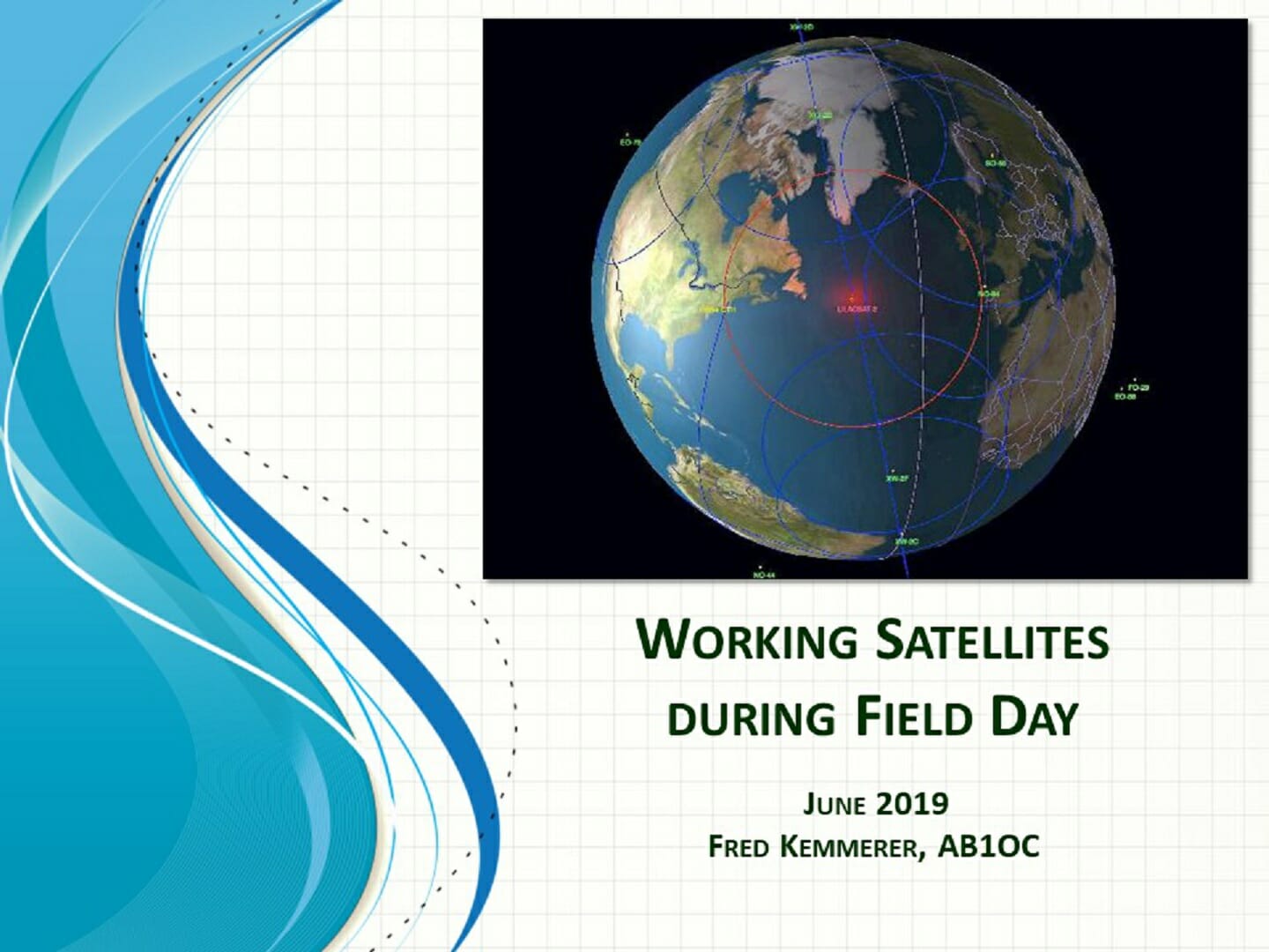
Satellites at Field Day

Field Day Satellites
Field Day 2019 Satellite Passes – Saturday

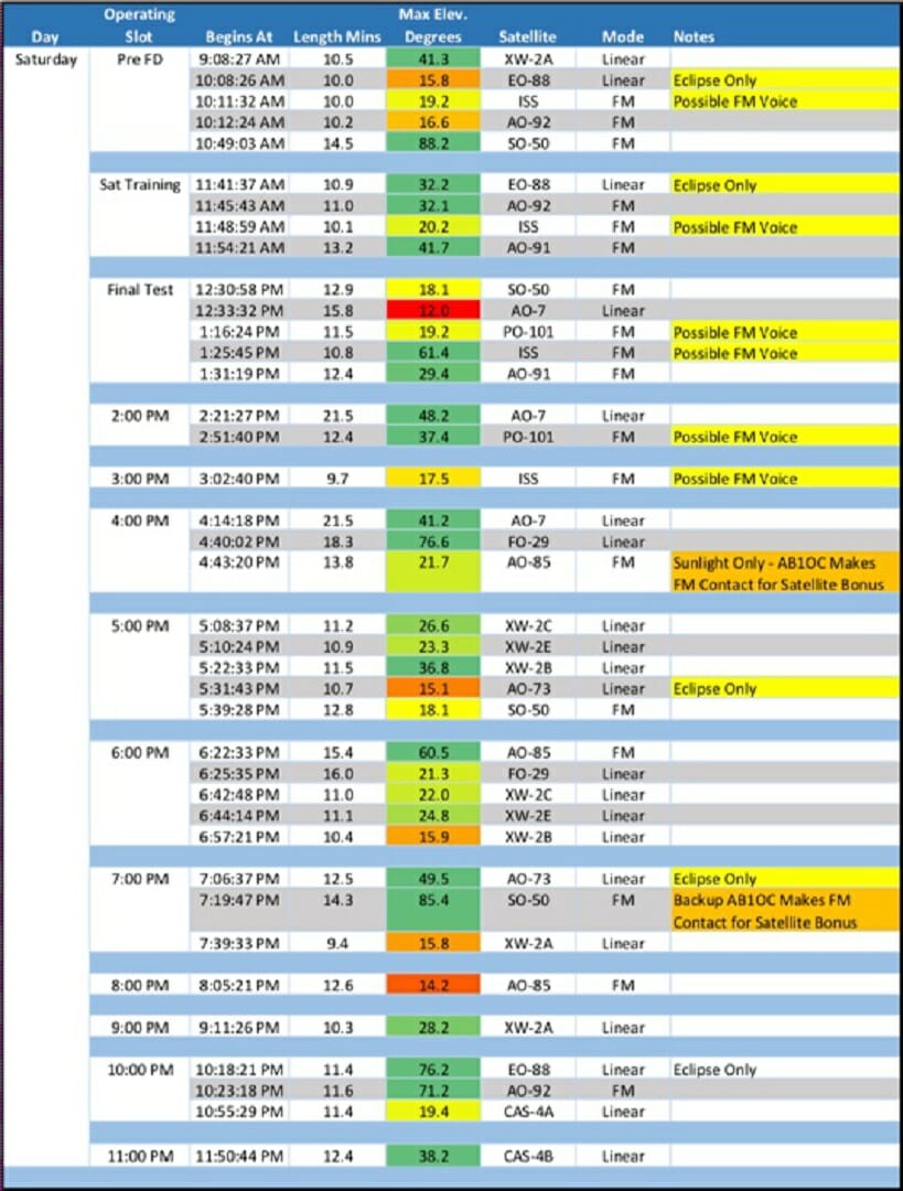
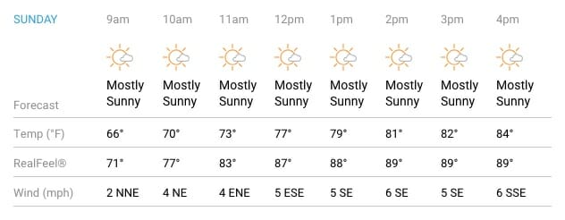
We will have a lot of great satellite passes during Field Day this year! The table above shows a summary for Saturday. Sunday passes are also very good! You can see view the passes and associated details in our 2019 Field Day Satellite Pass Book.

Field Day Satellites
Computer Controlled Satellite Station

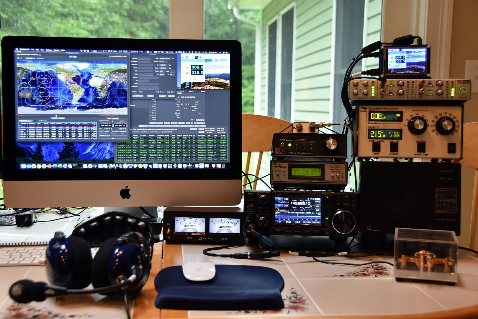
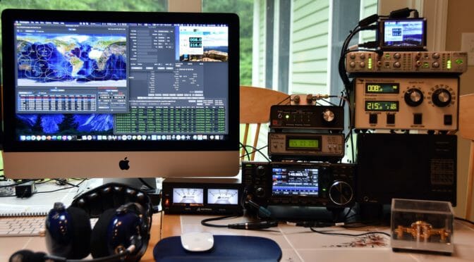
We will be using a Computer Controlled Portable Satellite station which features the new Icom IC-9700 Transceiver.

Field Day Satellites
Portable Satellite Antennas

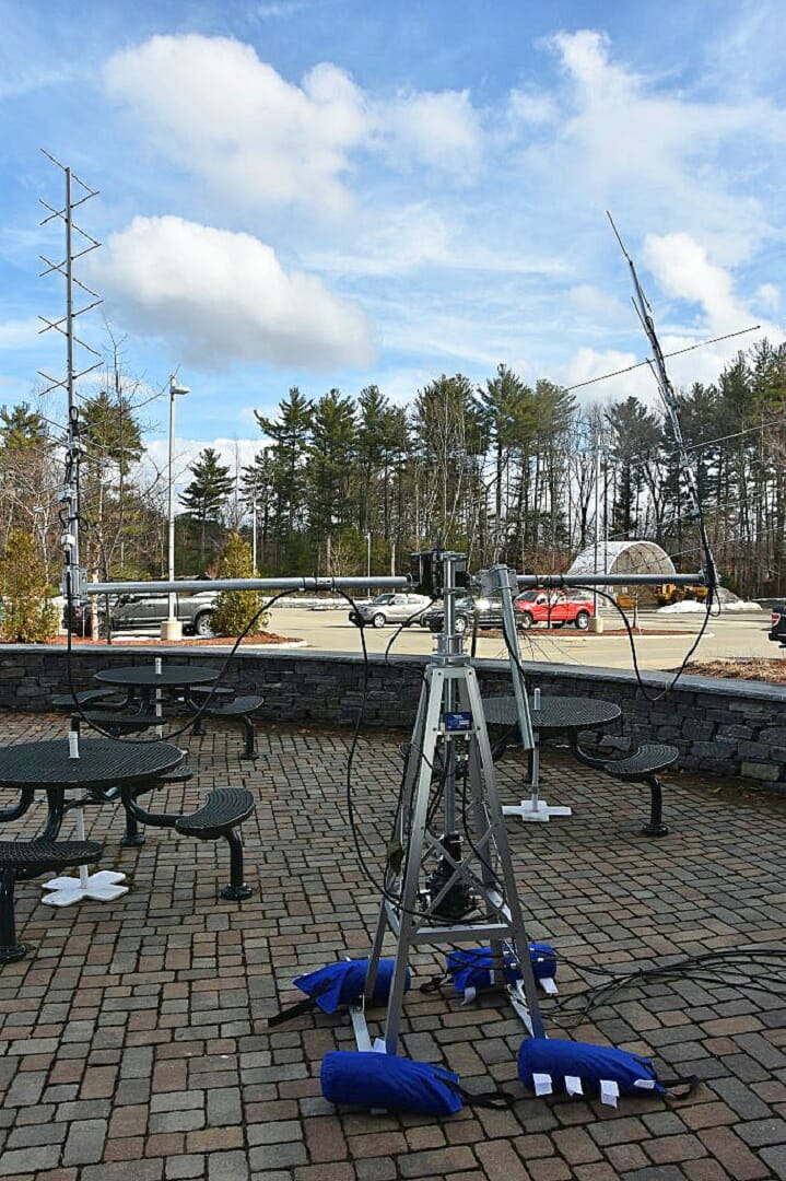
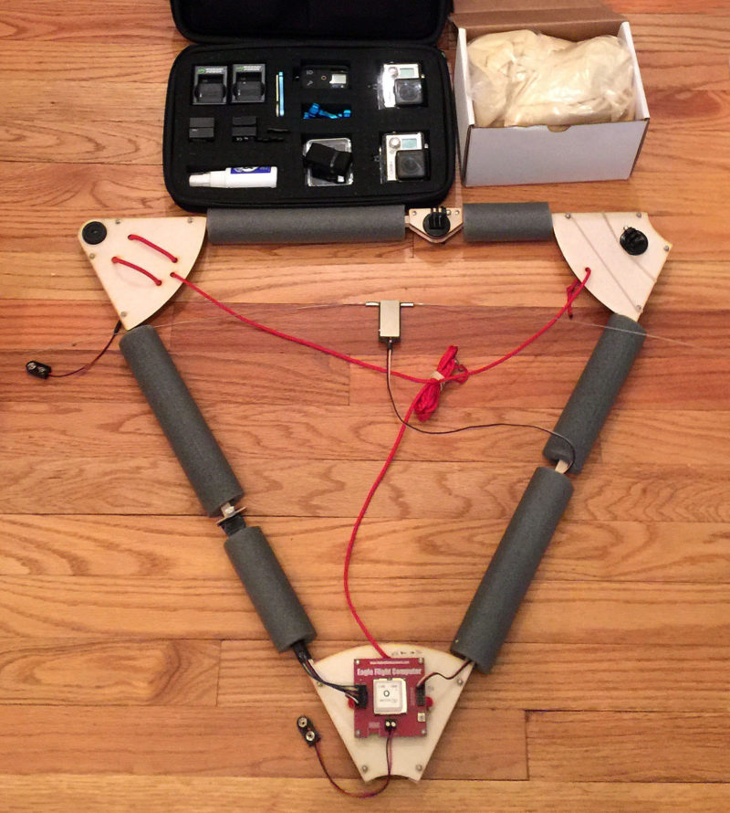
Our Portable Satellite Station uses circularly polarized yagis and an Az/El Rotator system to enable us to track and make contacts through LEO satellites. You can learn more about the station hardware and software here.

VHF+ Station

VHF+ Station
VHF+ Antenna System

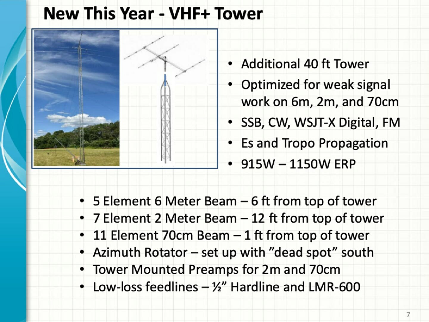
We are planning a serious VHF+ effort at Field Day 2019. We will be putting up a dedicated 40 ft tower with yagis, low-loss feedlines, and preamps for the 6m, 2m, and 70cm bands.

Icom IC-9100 Transceiver

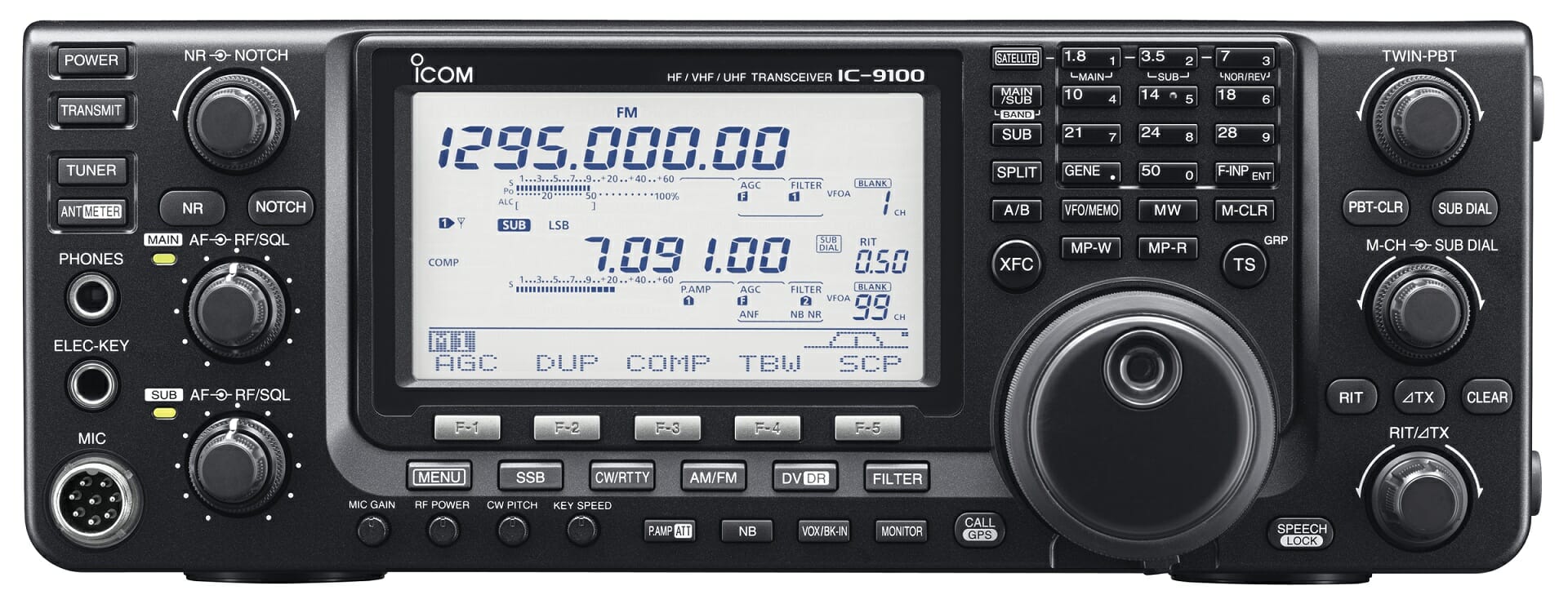
The VHF+ station will use an Icom IC-9100 Transceiver and will support all modes including FT8 Digital operation via WSJT-X.

Fox Hunting

Field Day Fox Hunting
Large N1FD Fox

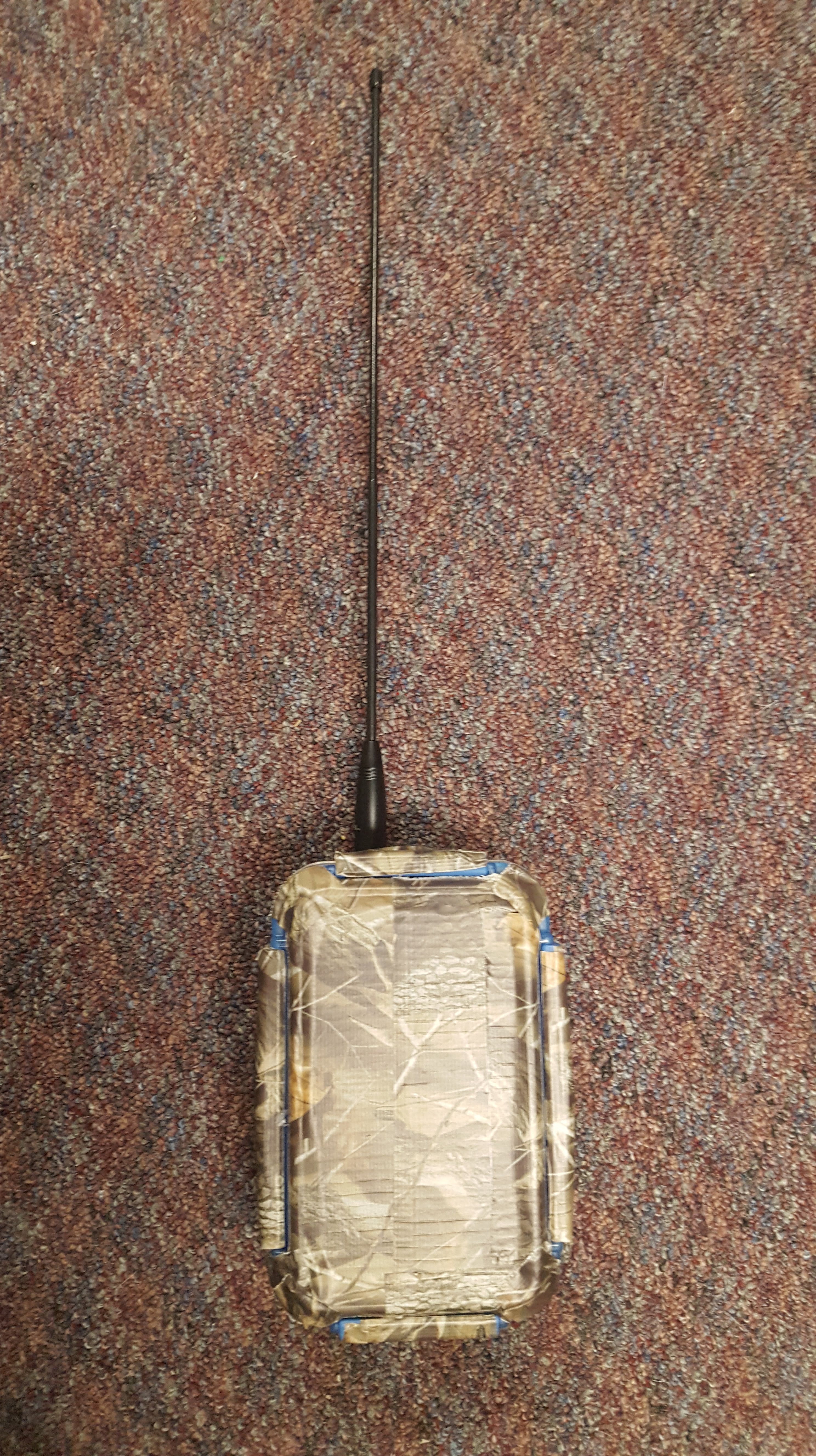
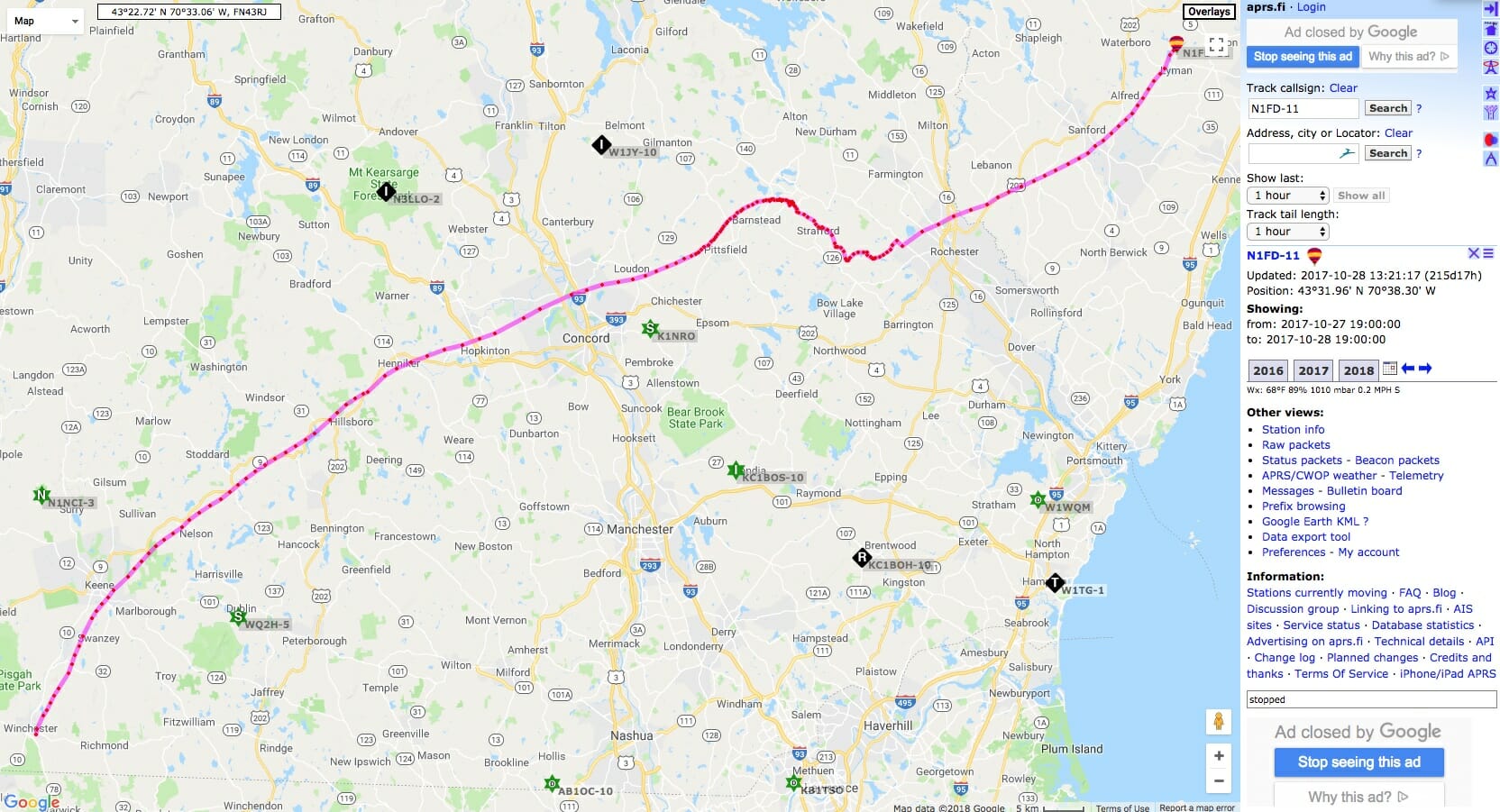
We will have several “Foxes” out during Field Day 2019. Fox Hunting (locating hidden transmitters using Radio Direction Finding) is a great way sharpen your RDF skills and have fun.

Training, Training, Training

Field Day Training
Field Day Satellite Training

We will be offering training on all of these activities at the start of Field Day 2019. Training will begin at 11 am at the VHF+/Satellite Station Tent. We will cover Satellite Operating, VHF+ Operating, and Fox Hunting then.

Field Day Training
Fox Hunting Training at Field Day

It might be worth coming to Field Day 2019 just for the training – Don’t Miss It!

See you at Field Day!

Fred, AB1OC


Satellite Station 4.0 Part 8 – GPSDO Frequency Locking

Frequency accuracy and stability become more challenging for transceivers that operate at 400 Mhz and above. Our 4.0 Satellite Stations operate at frequencies approaching 1.3 GHz and we want to be sure that their frequencies are accurate and stable. We decided to add GPSDO Freqeuncy Locking to the Icom IC-9700 in our Portable Satellite Station…

Source: Satellite Station 4.0 Part 8 – GPSDO Frequency Locking

We recently added a GPS Disciplined Oscillator (GPSDO) to the IC-9700 in our Portable Satellite Station 4.1. The addition was easy to accomplish and it locks our Icom IC-9700 Transceiver’s frequencies to the very accurate and stable clock from GPS satellites. You can read more about out GPSDO Frequency Locking project via the link above.

Fred, AB1OC

HAB-4 to Launch on Sunday from Hollis-Brookline High School

We are planning the fourth launch of our High-Altitude Balloon (HAB-4) this Sunday, June 9th between 10:30 am and 11:30 am ET. We will be launching locally from the Hollis-Brookline HS here in Hollis, NH. Read on to learn more about our HAB projects and how to track our HAB while it is in flight.

You can learn more about our HAB projects here on our website and you can view a video about our first three HAB launches above.

High-Altitude Balloon Launch Site and Weather

The weather and Jetstream conditions look good for our HAB-4 launch! The jet stream has finally settled down to a point that will enable us to launch locally from the High-School here in Hollis, NH. Nashua Area Radio Society members and friends are invited to join us for our launch.

HAB Launch
HAB Launch!

We have been working with students at the Hudson Memorial School and Bishop-Guertin High School here in NH. The students and their teachers will handle HAB-4 launch preparations and the launch. Launch preparations will begin on site at 9:00 am ET.

Weather Forecast for our HAB-4 Launch

The weather forecast looks great for our launch on Sunday with mostly sunny skies and moderate winds. These conditions should enable us to capture some spectacular video from HAB-4 during its flight! We are also planning to live-stream video from our HAB-4 launch and recovery to the Nashua Area Radio Society Facebook page.

Tracking Our HAB

I wanted to share some information about tracking our HAB as it flies. Our balloon will carry a GPS receiver and a 2m APRS Transmitter.

HAB Flight Platform
HAB Flight Platform

The onboard APRS transmitter will operate on the Amateur Radio standard terrestrial APRS frequency of 144.390 MHz and will transmit our HAB’s position, heading, speed, altitude and other telemetry data every minute during HAB-4’s flight. The transmitter is battery-powered and generates a 250 mW signal into a dipole antenna suspended from HAB’-4s flight platform. HAB-4 will use N1FD-11 as its call sign.

HAB-2 Flight Track on aprs.fi

HAB-4’s APRS packets will be picked up by ground-based Digipeaters and iGates and will be relayed to aprs.fi where the HAB’s current location and flight path can be tracked.  You can click on the link in the previous line to see HAB-4’s current location and flight track.

HAB-4 Flight Path Prediction

Based upon online HAB flight prediction calculators that we have been using, we expect the HAB’s flight to last a little more than 2 1/2 hours. The HAB should reach an altitude of about 110,000 ft before the balloon bursts and the parachute on the flight platform brings HAB-4 back to the ground at a safe speed. The above predictions will likely somewhat different from HAB-4’s actual flight path. Based upon the predictions, HAB-4 will be traveling approximately 42 km between its takeoff point and landing near Marlborough, MA.

HAB APRS Packet Information

Aprs.fi will store and display a copy of all of the APRS AX.25 packets transmitted by HAB-4 during its flight. Of particular interest to the STEM element of the flight will be the Balloon’s data on atmospheric temperature and pressure conditions at different altitudes.

All you need to track HAB-4 during its flight is Internet access and a web browser. Just click on one of the aprs.fi links here to see HAB-4’s current location and altitude. If you have an APRS ground station, you may also be able to receive HAB-4’s telemetry directly during the flight.

We will post updates on launch plans and the flight in the Youth Forum on our website.

You can join us for the launch. Here’s a map showing how to get to our launch site.

Fred, AB1OC

Radio Amateurs Developing Skills Worldwide