All posts by Nashua Area Radio Society

Webmaster for the Nashua Area Radio Society

2022 NARS Executive Committee Spotlight

Jon Turner (AC1EV) – President

Jon AC1EV
Jon AC1EV

“Here is AC1EV.  My name is Jon.”  I started saying this back in February of 2018 and have said it almost 11,000 times since then.  I self-studied and passed my Technician exam in February 2018 and self-studied and passed my General exam in March 2018.  I was in the middle of self-study for my Extra when I had a chance meeting with Charlie, a member of the Nashua Area Radio Society, at HRO in Salem, NH.  As we talked and discussed ham radio, I mentioned my study efforts and he said, “My club has a boot camp for Extra next weekend” Well, I knew what I was going to be doing that weekend, so I contacted Anita and joined the class.  Friday, Saturday and Sunday and at the end of Sunday I passed the exam and was an Amateur Extra.  The club gives a year’s free membership to people who pass their exams with them, and I was so impressed with the whole operation that I joined.  I live in Tewksbury, so attending meetings meant a 30-mile ride, each way, but It was completely worth it.  Within months I saw the club’s field day operation and was able to operate in 13 Colonies.  Both events were very exciting.  I quickly saw that NARS had lots to offer new hams and had the philosophy that if you wanted to participate, they would not only let you but would actively assist in helping make it happen.

From that quick start I had a chance to be engaged at all levels with many club activities, write for the newsletter and website and even help Fred with getting students to contact the ISS.  A little over two years ago the club secretary moved away from the area and created an opening on the NARS Executive Committee.  Fred asked me if I would be interested in the position, and I was.  Last year I was elected again as Secretary and have enjoyed working with the leadership team to help make NARS what it is today.  This year, with Fred becoming the ARRL New England Division Director, there was an opening on the Executive Committee for President.  I think I declined the role 2 or 3 times.  Still, I knew that it was an important thing to do and eventually with much discussion with my wife Stephanie, I decided to go for it.

In my time in the club, prior to being elected President, we’ve trained many dozens of new hams, helped more dozens of hams upgrade their licenses, finished with top scores in Field Day, 13 Colonies and other operating activities, and were selected as the Dayton Hamvention 2019 Club of the Year.  (Just to name a few) BTW, NARS was on the cover of the ARRL flagship magazine twice in the past year and a half.  My immediate goal is to help the club to continue to do those things that made the above possible.  Next, I want to become fluent with the club’s operations so I can take advantage of any new opportunities to help grow our membership and help our members grow in the hobby.  Above all, I want to keep the spirit of the club that welcomes anyone with interest and desire to participate in any activity at the highest level they can.

I’ve asked each of the EC members to put together a few sentences about themselves to help you get to know them a little better.  We have two new members this year and some of us old hands have new roles.  Fred becomes our new Programs Chair; Lee is our new Treasurer and Peter is our new Secretary.  I moved from Secretary to President.  Jamey remains our Vice President, Anita remains the Membership Chair and Jim remains our Activities Chair.  Thanks to all the members of the EC for their hard work and support of the club.  Here are some of their thoughts.

Jamey Finchum (AC1DC) – Vice President

Jamey AC1DC
Jamey AC1DC

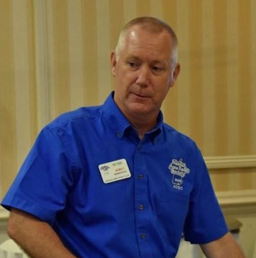
I was first licensed in 2015 through the NARS classes that I found while doing a web search. I wasn’t sure of all that was involved in amateur radio, but really enjoyed the class and was convinced to take the general course the following month. I’m not sure why, but during one of our breaks Fred (AB1OC) had a station set up and we were hearing someone talking from Cuba. It blew me away that we could be hearing someone from as far away as Cuba from a radio set up in a break room attached to an antenna on a truck! I have been hooked ever since!

I enjoy contesting, portable, and mobile operations and I’m always learning something new. I am looking forward to the new year with the club and hopefully having some in-person events with SOTAs, POTAs and other activities.

Lee Duval (KC1GKJ) – Treasurer

Lee KC1GKJ
Lee KC1GKJ

I received my technician license in 2016 through the Nashua Area Radio Society around that time I also became a member of ARES. This spring I started looking through the website for NARS and was impressed by all the training information available and decided to join and go to field day. Field Day was a great experience. Everyone was very welcoming, and I was able to learn all about new things available to amateur ham radios. I was thrilled to participate in K2K and learn about contesting and digital modes and this of course led to my desire to become a General and set up an HF station. After getting advice from some members, I have set up my station with an ICOM 7300 and a Buckmaster dipole. With the help of Fred, I was able to set up my digital side to be able to do FT-8. In December I upgraded to my General and have loved being able to use the extra frequencies and both SSB rag chewing all over the world and making digital contacts in places I have never even heard of!

Talking with Fred and Anita one day we were talking about the treasurer’s position, and I asked him if he knew I was in banking for 14 years? They did not but this let me to becoming the Treasurer. I look forward to being your treasurer. All reports are reviewed and approved by the Executive committee and audited. If anyone has any questions, please feel free to email me at [email protected] along with a phone number and I will be glad to call you back and answer any questions you have.

Peter Wolczko (KC1FNF) – Secretary

Peter KC1FNF
Peter KC1FNF

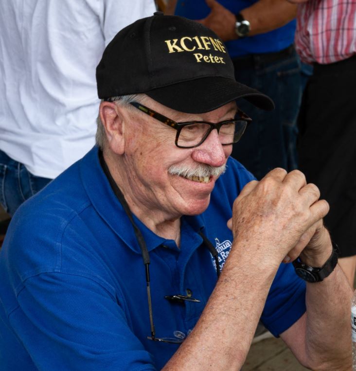
I joined Nashua Area Radio Society in March of 2019 with a very warm welcome.  At the time I had been a Ham for about 3 years with a General License.  In April of 2019, I studied for the Amateur Extra license and attended the 3-day Extra Class training at Fred and Anita’s home, where there were several instructors teaching with a broad knowledge of Amateur Radio topics.  I really enjoyed the class.  I passed and received my Amateur license.  I am very honored to have been nominated and elected to the position as Secretary of the Nashua Area Radio Society.

Fred Kemmerer (AB1OC) – Programs Chair

Fred AB1OC
Fred AB1OC

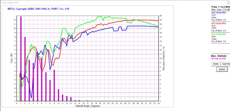
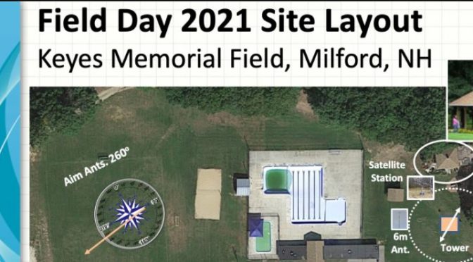
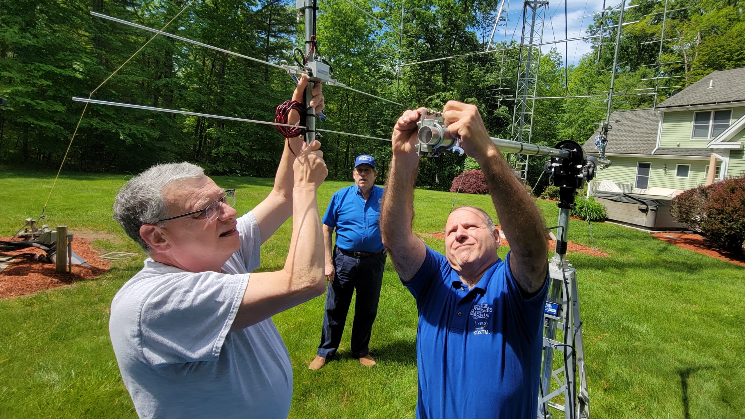
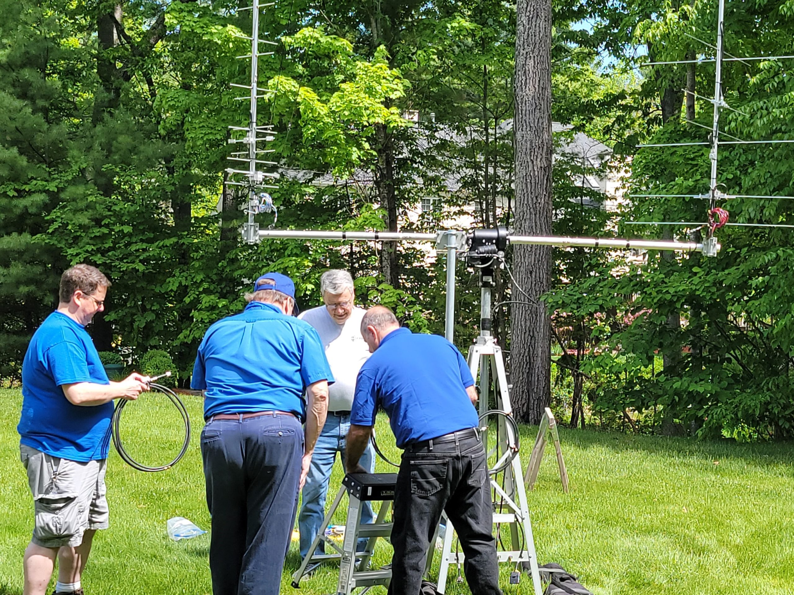
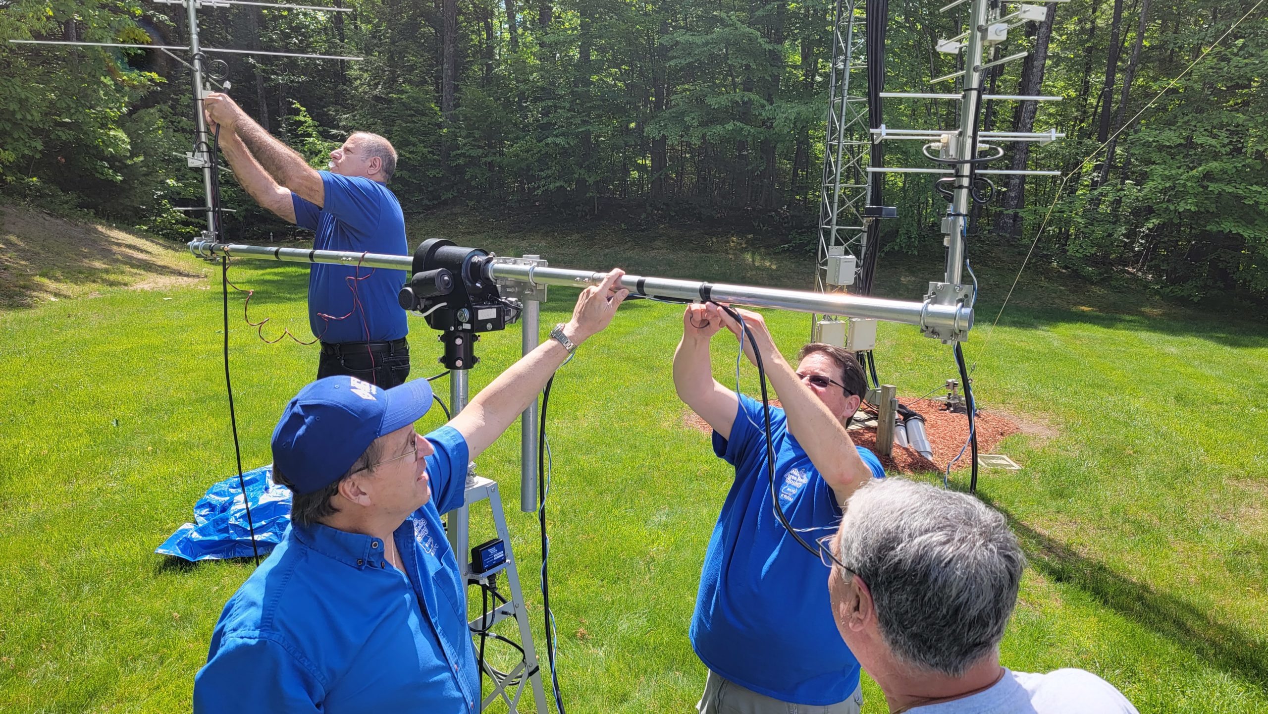
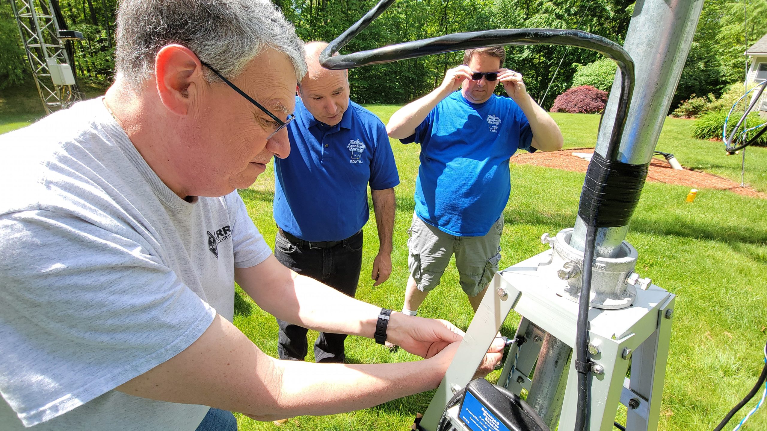
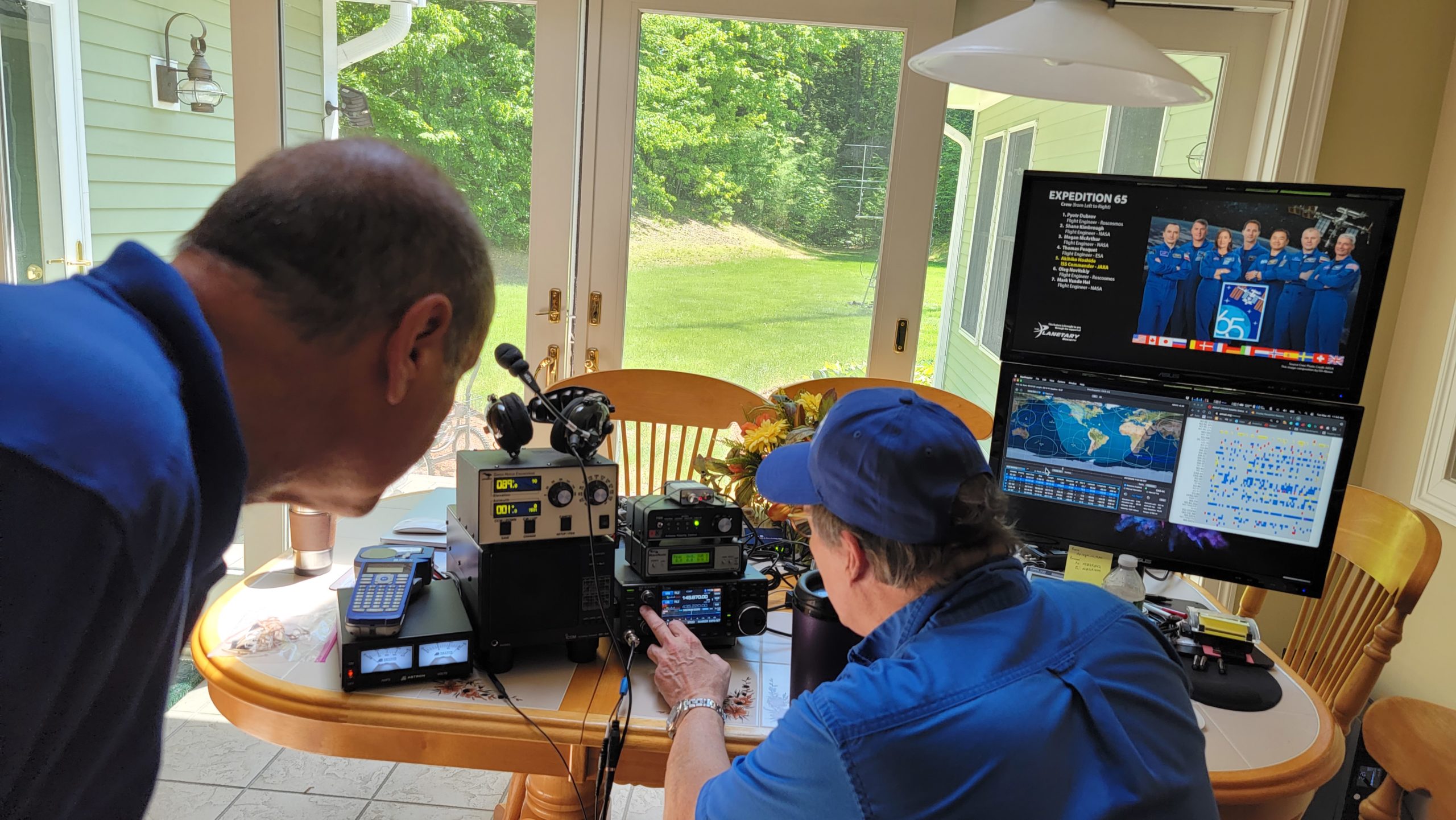
2021 was a busy year for the Nashua Area Radio Society. Our licensing and new ham development programs were all online. We held a total of 7 license classes and two Ham Bootcamp sessions. We held our first post-COVID in-person Field Day in June. The turnout was great, and it was nice for folks to be together in person doing Amateur Radio again. NARS also returned to HamXposition with our Ham Radio Display in 2021. We also had the opportunity to teach classes about Amateur Radio in a local middle school and I was involved in helping five schools to make contacts with astronauts on the International Space Station via Amateur Radio. NARS partnered with Bishop-Guertin HS to help them make their contact. I also helped a school in Maine prepare for their contact and I served as the ARISS ground station for contacts with groups in Arizona, Canada, and Ohio. ARISS activity is continuing into 2022 with work to help Sussex County Charter school in New Jersey to make their contact early in February 2022 and I will be serving as the ground station for a Scout group in Australia who will make their contact on Tuesday, January 4th. The second half of 2021 began a new chapter in my Amateur Radio experience with a successful campaign to become the ARRL New England Division Director. I am looking forward to this new role which begins today. I will also begin serving as NARS program chairperson in 2022 and I am looking forward to this new role as well.

It would be impossible for NARS to accomplish all these things and more without the dedication of many member volunteers. Giving back to Amateur Radio the way we do at NARS is a model for the entire Amateur Radio community. I want to personally thank all of the folks at NARS who contributed to our many projects – Licensing, Bootcamp, Field Day, ARISS, Classroom work, HamXpositon, and other projects. You all make NARS what it is – one of the best Amateur Radio Clubs on the planet. Happy New Year as we look forward to 2022.

Anita Kemmerer (AB1QB) – Membership Chair

Anita AB1QB
Anita AB1QB

As membership chairperson for the Nashua Area Radio Society and coordinator of our licensing and new ham development programs, I would like to thank all of our volunteer instructors, volunteer examiners, and Bootcamp instructors for helping us in 2021 to continue our mission of bringing new hams into amateur radio and helping them to get on the air.  Through our online classes we helped 72 people get a new license or upgrade and helped over 600 hams or prospective hams get on the air via our spring and fall Ham Bootcamp.

I would also like to welcome all the new members who have joined us this year.  In 2021, we had 79 new regular members and 101 new internet subscribers join the Nashua Area Radio Society.  I would like to thank all our volunteers for making the Nashua Area Radio Society one of the best clubs in New England and I am looking forward to an even better 2022!

Jim Lajoie (K1BRM) Activities Chair

Jim K1BRM
Jim K1BRM

Jim was elected to the role of Activities Chair in the 2019 club elections.  He has been busy arranging activities such as SOTAs and POTAs along with monthly club breakfasts.  The weekly repeater net and HF chat nets are also among the activities Jim helps to manage.  We look forward to more activities as conditions allow.

Jon, AC1EV

Introduction to HFTA – High Frequency Terrain Assessment and more…

What is HFTA

HFTA stands for High-Frequency Terrain Assessment.  Some documentation refers to it as High-Frequency Terrain Analysis.

HFTA is a software tool that generates the vertical radiation pattern of horizontally polarized antennas taking into account the profile of the surrounding terrain. The irregularity of local terrain has a profound effect on vertical radiation patterns. Note that HFTA does not compute radiation patterns for vertically polarized antenna radiation.

Azimuthal Maps

Request Azimuthal Map

HFTA provides performance information for your antenna taking account of the terrain profile in a particular direction.  Do you know what is out there in any direction?  Standard Mercator maps show a representation of the world, but do not provide important information that is of use to Hams.  There is a website that will create a map with your location at the center of it.  It is free and all you need to know to use it is your grid square info.  The more info you have the more accurate the map is.

Check out   https://ns6t.net/azimuth/azimuth.html

Tewksbury Azimuthal map

Above is a map for Tewksbury, MA

Yaesu Rotator Controller

You can put the map on your rotator controller to show where it is pointing.  Some computer-based rotator control programs can also use the image.

Take-off Angles

ARRL Take Off Angles

Why use HFTA

Use HFTA for planning an HF station scientifically.  It can assist with determining the optimal antenna location and height. HFTA takes ground elevation data, frequency, and the height of the antenna to calculate the take-off angle in a specified direction. It is particularly useful for Hams interested in DX and contesting. Many of us use some type of propagation prediction tool to give us an idea of what bands may be open at a given time and to a specific location.  Once the terrain profile and antenna information are configured the results can be used to provide a tool for propagation prediction that is custom tailored to your precise situation.  This is very helpful when formulating strategies for contesting or hunting down rare DX.  Terrain around your antenna up to 10,000 feet has a significant impact on your signal.

HFTA Models
HFTA Models

Typical questions that HFTA can answer

  • How high should my antenna be?
  • Is it worth spending more money on a taller tower?
  • My mast is up 35 feet. Is it worth it to extend it to 45 feet?
  • Why can’t my antenna hear signals from ??
  • About to by a new house? Is the house location well suited for Ham Radio?

How does it work

1. Generate terrain profile data files.  These are created using digital terrain data available from various online databases. There are a few additional programs that can be used to create these files and the HFTA instructions cover the required steps in detail.

2. Choose the type of antenna and the number and heights of antennas in a stack.

3. Select the type of antenna to be used.

4. Select an Elevation-Statistics file for your targeted receiving area.  This file will include your station location (receiving area) and the area from which you will be receiving signals.

The software includes files with statistics that were computed for all the times over the 11-year solar cycle when each band was open.  The Antenna Book’s data contains files for all regions of the USA to Europe (EU), the Far East (JA), South America (SA), South Asia (AS), Southern Africa (AF), and the South Pacific (OC), plus data files for a wide variety of other transmitting sites throughout the world. You choose the general area where your transmitter is located during initial installation of the HFTA program.

How to get HFTA

How to get HFTA
How to get HFTA

HFTA is included in the ARRL Antenna Book (currently 24th Edition).  It is part of the package that includes the book when you get it for download from the ARRL.  It was also included in a CD that came with the physical book.  The e-book or Kindle is available from different sources.  To be sure you get the software files associated with the book I suggest ordering it directly from the ARRL.  Here is a link:  http://www.arrl.org/shop/ARRL-Antenna-Book-eBook-Windows-Version/

K6TU.NET

K6TU.NET
K6TU.NET

The website https://www.k6tu.net/ is an excellent resource in combination with the HFTA software and offers many tools and resources beyond those that support HFTA.

Users need to register for free to use the tools and there is also a subscription service which offers more tools that go beyond the scope of HFTA available.  To create HFTA Terrain Profiles, this website makes it very easy and offers very accurate data for stations located in the USA.

K6TU.NET provides a framework of simple to use forms to build propagation predictions or Terrain profile requests. Use the Resource menu at the top of the page to access guides, FAQs and background information.  Use the Getting Started page to start with a tutorial which will guide you through the steps to create your first prediction.

Generating an accurate terrain profile

K6TU.NET now has the capability to generate a set of profile files for your location by simply filling in a form and submitting the request. Much like generating a Propagation Prediction, the site captures the information necessary to fulfill the request and then generates the results in the background. Once the results are available, an email is sent to you with a link to the results.

Generating a Terrain Profile Request is very simple and starts by selecting Terrain Profile from the New menu at the top of the page when you are logged in as a registered user. You do NOT need to be a subscriber to K6TU.NET to access this service – it is freely available to anyone with an activated account.

When the request is completed, the site creates a Terrain Profile Result which has a link to the ZIP file containing the terrain profile files (360 of them, one for each degree of azimuth) together with an explanation of the source of the terrain data for this profile.

Terrain Data
Terrain Data

The screenshot above shows the 360 files for the terrain data for my QTH in Tewksbury, MA  I have another folder with the terrain data for my NH QTH as well.

HFTASweep

HFTASweep is a program “wrapper” for the ARRL HF Terrain Analysis program (HFTA). HFTASweep runs HFTA 90 times programmatically to model your HORIZONTAL polarized antenna over the actual terrain around your location. The program captures the results for each azimuth direction (4 different azimuth angles at a time) and at the end, builds a VOACAP type 13 antenna model as a file called antenna.13. You can upload type 13 antenna files to K6TU.NET and use them in the different prediction options by creating an Advanced Station Configuration from the New option under the Navigation menu.  Once you have the type 13 antenna file you can use it to create custom tailored propagation forecasts.  Here are a few examples:

HFTASweep
HFTASweep

This is 20 meters in May.  There is one chart per hour.

Custom Tailored Propagation Forecasts

One Hour Forecast
One Hour Forecast

Here is a close-up of one hour on 20 meters.

Contest Strategy

Contest Strategy
Contest Strategy

Another feature is to prepare multiple band reports to use for formulating contest strategy. Here is an example I created for my NH QTH for 13 Colonies back in July. There are very good instructions and examples on the K6TU web site. It is worth checking out.

How to use HFTA

Blank HFTA and Terrain Files

1. Launch the program

2. Select the terrain files you will use for this assessment by clicking in the box.  In this example we will examine performance for 50 degrees, which is towards Europe.  This Terrain File is for my MA QTH

HFTA Antenna Type
HFTA Antenna Type

3. Click in the Ant. Type box to select the antenna type from a pull-down list.  Enter the antenna height in the appropriate box.  You can stack antennas up to 4 high!

4. Repeat for other antennas, locations, and heights you wish to compare.  In this example I will add a 3 element yagi at 34 feet at my NH QTH (just select the Terrain Profile from that location) and a 3 element yagi at 45 feet from the NH QTH.

Add Elevation File
Add Elevation File

5. Enter the Frequency

6. Select an Elevation file.  These are included with the HFTA software.  They are the files derived from the 11-year statistical data mentioned above. This example is for Boston to Europe.

7. Check off the boxes for terrain for each antenna selected and HFTA will generate a profile for that compass heading.

Terrain Profile
Terrain Profile

8. The Options button lets you configure units of measurement, Diffraction on/off, and Soil Conductivity (among other things).  I have Diffraction turned on since I am around 3 miles from a ridge that is around 200 feet above my antenna. The chart makes it look like I am pointing into the hill, but it actually calculates out to be only 0.76 degrees up from my antenna.  I believe my soil in NH is “Good Soil” but I selected Average Soil to create a conservative assessment.

Options
Options
Ready to Compute
Ready to Compute

9. Click the Compute button to generate the chart.

My Results with HFTA

The Output Graph can be resized.  Here are my results for the three antenna configurations pointing to Europe:

My Results
My Results

The Purple bars show the take-off angle plotted against the percent of time that signals arrive at that angle.  This data is what is in the .prn files that you enter in the Elevation File field.  Each antenna profile’s performance is represented by the colored line on the chart.

There are some very interesting things that show up on this chart:

1. The Spiderbeam at 33 feet has better performance at low angles than at 45 feet.  Also, where the higher configuration is better, it is not a meaningful difference.

2. Both the Spiderbeam and the Hexbeam are adequate for coverage to Europe.

3. At this azimuth (50 deg) for some take-off angles the Spiderbeam has more than a 10 dBi advantage over the Hexbeam!  This is before any radio or amp is added to the calculation.

Figure of Merit

Figure of Merit
Figure of Merit

HFTA uses these elevation statistics, which indicate what percent of the time a signal arrives at a given elevation angle, and compares this info to your elevation plot, generating a relative performance rating called Figure of Merit, expressed in dB.

The software produces a “figure of merit” which is each antenna’s merit based on gain at takeoff angles where, statistically, the most prevalent signals can be expected. If you have great gain at takeoff angles where most of the time no signals are arriving, the FOM is low.  When comparing different antenna configurations, the FOM can be used to identify which has an advantage. For the Spiderbeam used in my Europe example, the FOM is the same for 33 feet and 45 feet.  The effort and risk to elevate the antenna does not appear worthwhile in this case.

Real World Example

Recently, I noticed a station from Kenya spotted on the cluster.  I took a few minutes and was able to make a call successfully to 5Z4BU.  I don’t often hear Kenya on the radio, so I ran an assessment using 77 degrees and the Africa Elevation file.  Here are the results:

Real World Example
Real World Example

In this case the Spiderbeam at 45 feet would have an advantage, but the antenna at 33 feet was still capable of receiving signals from any likely take-off angles.  The FOM for the 45-foot antenna was 1.2 higher than the 33-foot antenna.  The Hexbeam in MA may have been able to make the call, but there was a pileup and the additional gain from the Spiderbeam really helped.  I was able to make contact in 4 tries.

Australia and New Zealand

260 Degrees AZ Map
260 Degrees AZ Map

Here are two more examples to review.  First, we’ll look at Australia and New Zealand.  I’ll point my antenna at 260 degrees, which splits the difference between them.

Here is the terrain profile compared with the path covered on the map.

Lake Terrain Profile
Australia and New Zealand

The chart above shows that although New Zealand is around 9,000 miles away, it is not difficult to make contacts there as there are many take off angles that can give successful results.  You can select in the chart to capture a close-up of details.

Australia and NZ Close-up

The chart shows that the Spiderbeam at 45 feet will receive signals well at 1 degree and it looks like it will also at the 34-foot height.  The Hexbeam will likely miss signals at 1 degree but should handle 2 degrees fine.  New Zealand was one of my first Pacific DX QSOs and done with an OCFD and 100 watts.

Japan

Next, we can check out Japan, which is at 335 degrees.  We’ll review the steps again:

Japan
Japan

1.Select the Terrain files from each location for 335 degrees

2.Confirm Antenna type and heights are set properly.

3.Select the Elevation file

4.Click Compute!

Japan Chart
Japan Chart

This chart has lots of useful information.  Unfortunately, it does not indicate that I will have a high probability of success contacting Japan.  According to the chart, 20% of signals from Japan will come in around 1 degree and 15% at 2 degrees.  Both antennas will fail at this angle.  The Spiderbeam will have success from 3 degrees and higher.  It is interesting to note that the Hexbeam will perform better at 6-degree take-off angle.  Japan is only 6,700 miles away, but you can see it is way more difficult to reach than New Zealand.

Conclusion

  • This has been a simple introduction to HFTA. There are many documents and videos available that discuss the features of the program and strategies for using it.
  • How well an antenna “plays” depends on take-off angle to the target area, antenna height and local terrain
  • Lower is sometimes better.
  • More than one antenna per band will help your overall signal presence.
  • Design your antenna farm to cover all angles. If you can’t, choose what is important to you.
  • It is easier to make changes in the design stage of your antenna project. Time spent with this assessment tool can save big dollars and yield a better installation than trial and error.
  • The ARRL Antenna Book is a terrific resource. This presentation was based on only a tiny fraction of what the book covers. It makes a great gift, too!

Helpful Links

The ARRL Antenna Book for Radio Communications 24th Edition https://www.arrl.org/arrl-antenna-book

K6TU.NET | Propagation as a service

Practical Notes on Terrain Assessment (What I Have Learned in the Last Dozen Years) (seapac.org)

take-off angles Archives – KB6NU’s Ham Radio Blog

INSTALLATION (orcadxcc.org)

HFTA and your station (qsl.net) – great presentation info

December 08, 1997 by N6BV (arrl.org) – instructions

Takeoff Angles & HF Terrain Analysis (HFTA) — Presented by Kevan Nason N4XL – YouTube

Jon, AC1EV

Field Day Satellite Station for 2021 – Setup and Test in Hollis

On Wednesday, May 25, Jon – AC1EV, Jeff – AC1FX, Jim – K1BRM, and Vince – KD2TMJ met at Fred – AB1OC’s QTH in Hollis, NH to set up and test the satellite antenna, radio, computers and other gear our club, Nashua Area Radio Society will be using this year at Summer Field Day. Here are some pictures of our Field Day Satellite Station test.

Satellite antenna Base

The satellite antenna base is on the lower right of the above picture. The much larger antenna on the left is an EME array and as you might guess, is not very portable.

Preparing the base
Preparing the base

We placed the small Glen Martin tower with the AZ-EL rotators installed on the lawn and aligned it using a compass.

Field Day Satellite Station - Base aligned and leveled
Base aligned and leveled

We used doorstops under the tower legs to level it and sandbags to hold it steady. There are bubble levels on the tower to make it easy.

Install the support arms

The support arms will hold the antennas.

Tighten support arm bolts
Tightening the support arm bolts

All of the bolts need to be tight. The antenna moves quite a bit and needs to maintain its shape.

Field Day Satellite Station - Installing 70cm antenna
Installing 70cm antenna

Fred (AB1OC) installing the 70cm antenna and aligning it properly in its brackets.

Tighten bolts on 70cm

Vince (KD2TMJ) and Jeff (AC1FX) tightening the bolts for the 70cm antenna.

Install 2m antenna
Install 2m antenna

Vince (KD2TMJ) and Jeff (AC1FX) prepare to attach the 2m antenna.

Field Day Satellite Station - Preparing to wire the antenna array
Preparing to wire the antenna array

There are many wires that need to be connected to the antenna array: control wires for the AZ-EL rotator, Coax for the antennas, control wires that shift the polarization of the antennas, etc. Every connection outside has a matching connection in the shack. There are some wires already connected to hardware that remains attached to the antenna tower, such as the pre-amplifiers.

Dressing the wires
Dressing the wires

Since the antenna array can spin horizontally as well as tilt vertically all wires need to be secured so as not to tangle as the antenna moves. In addition, care needs to be taken to make sure each connection is correct to avoid any short circuits or other negative results. There needs to be enough slack to allow free movement for the antenna but not enough to allow any excess to become caught by moving parts.

Plugging in polarity control line
Plugging in the polarity control line

Jim (K1BRM) and Vince (KD2TMJ) watch as Jeff (AC1FX) connects another control line.

Field Day Satellite Station - Kitchen test setup
Field Day Satellite Station Test Setup

After the initial successful test of our Field Day Satellite Station, Fred (AB1OC) shows Vince (KD2TMJ) the radio setup and what he will do to make a QSO.

Fine Tuning on Successful Test

After a successful QSO Fred (AB1OC) makes a small adjustment by ear to a beacon from a satellite. On the monitor at the right of the screen, there are circles on the map that represent the locations on the ground that have a clear line of sight to the satellites. There is one red circle and that one indicates the satellite visible to our location and that the radio is tuned into.

ARRL Field Day is the most popular on-the-air event held annually in the US and Canada. On the fourth weekend of June, more than 35,000 radio amateurs gather with their clubs, groups, or simply with friends to operate from remote locations. There are many different ways hams participate. Some stay home and operate their normal stations’ others take their radios outside and create a simple temporary station. Small groups of friends can do likewise and take their equipment to an outdoor location and share the experience together. The Nashua Area Radio Society and many other clubs take It in steps beyond that. We have access to the equipment and skills to set up a multi-radio station that is networked together and equipped to allow multiple users to operate simultaneously. We set up towers with beam antennas to get the most out of the radios as possible. One of our primary goals for this event is to provide an opportunity for our members to operate in a sophisticated off-grid ham radio environment and we will have up to 50 different operating slots for our members to sign up to operate in. This way, even newly licensed hams with no equipment can have a chance to operate and join the rest of us in participating in this fun event.

Jon (AC1EV)